How AI and satellite monitoring are boosting global agricultural production

From climate volatility and increasing sustainability demands to the pressure to feed a growing international population, modern agriculture faces multiple challenges. Artificial intelligence and satellite monitoring systems can help you shift toward data-driven, predictive and efficient farming. Here’s how this technology is positively impacting agriculture production on a global scale.
The state of global agricultural production
Modern agriculture exists at the intersection of immense global pressures and complex challenges. The industry must feed a growing population, which is expected to reach approximately 10.3 billion by around 2085. In addition, farmers are dealing with the unpredictable effects of climate volatility, from prolonged droughts to sudden floods. These issues strain vital resources such as water and arable land.
Farmers also grapple with ground-level hurdles that complicate daily operations, such as supply chain disruptions, which make farm management difficult. Compounding this is a persistent labor shortage, a challenge made more acute by a demographic shift in many regions.
Farmers represent the oldest workforce in the U.S., and those 65 and older own 40% of the nation’s farmland. As the population of agriculture professionals ages, the physical demands of farming can become more challenging, intensifying the need for more efficient, less labor-intensive solutions. This combination of pressures highlights the need for technological evolution.
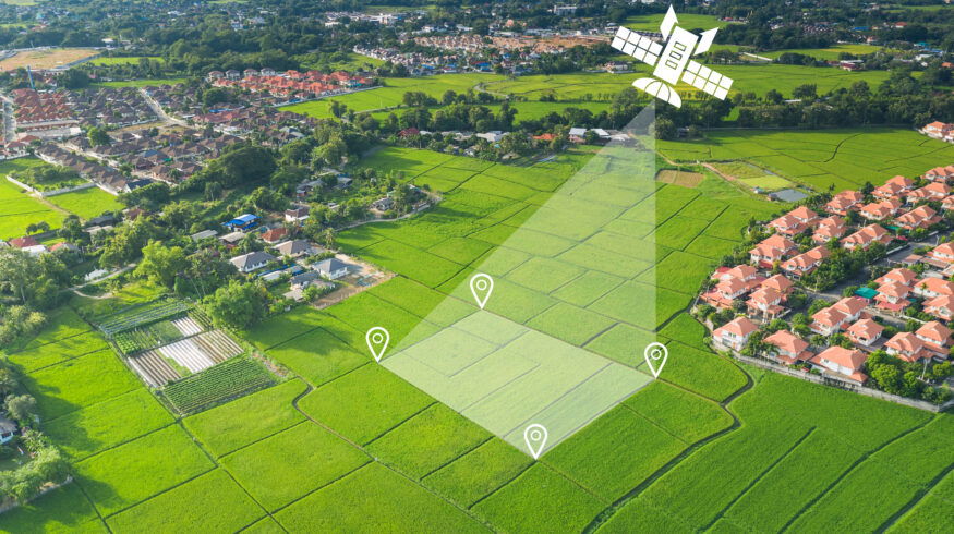
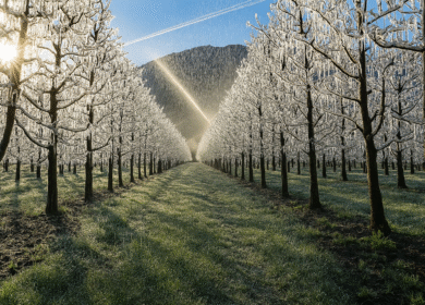
Precision monitoring at scale with satellite systems
Satellite monitoring provides greater visibility into your operations, enabling you to spend less time manually searching your land. Instead, you can spot problem areas earlier and more efficiently dedicate your physical efforts.
In the Czech Republic, Gisat’s DROMAS Agricultural Crop Monitoring and Farming Management Service platform uses satellite imagery and data to monitor crops across the country. DROMAS will expand across Europe to boost efficiency and sustainability in farming operations. This technology can give farmers greater oversight into their produce’s health, revealing plant stress, disease and nutrient deficiencies that are harder to spot on the ground.
Satellite systems can also assess soil moisture and water use to help you optimize irrigation, leading to less wasted resources and, therefore, potential savings. Born from a partnership between NASA and the Indian Space Research Organisation, the NASA-ISRO Synthetic Aperture Radar monitors crop planting and growth cycles, providing insights into irrigation practices. It can detect moisture content in plants and soil and generate around 80 terabytes of data products each day. These capabilities can increase agricultural production by improving crop health and resource use.
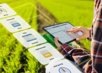
AI-based actionable agricultural insights
AI can turn raw satellite data into actionable intelligence. Analyzing historical and real-time information enables it to forecast harvest outcomes with increasing accuracy. These capabilities support more proactive agricultural planning. For instance, you could address crop deficiencies in one area by investing in produce with a more positive outlook.
Models can also reveal patterns that indicate potential pest and disease outbreaks. Some AI disease detection systems have identified diseases in tomatoes, wheat and grapes with over 95% accuracy. These insights can help you avoid broad pesticide applications and instead opt for more targeted interventions. This reduces wasted resources and supports sustainability, as pesticides often negatively impact the environment and wildlife.
AI insights can also support more optimal use of other resources, such as fertilizer or nutrients. The tool can suggest the precise amounts to use in specific fields or zones of the farm. This capability can lead to greater production and healthier crops.
Breaking down silos through integration
The actual power lies in combining AI’s capabilities with satellite monitoring systems. While these tools are useful on their own, a unified system gives you greater visibility into your operations and more opportunities to leverage data-based insights to boost production.
A method developed by the Brazilian Agricultural Research Corp. and the State University of Campinas exemplifies the power of integrating AI and satellite monitoring to support farmers. Researchers paired AI and satellite imagery to identify areas with crop-livestock systems in São Paulo and Mato Grosso. By mapping and monitoring these areas over time, stakeholders can more efficiently manage resources, optimize land allocation and diversify agricultural activities to lead to greater production and income.
An integrated approach like this breaks down silos between datasets, creating a continuous feedback loop of taking actions and monitoring results to prompt the system to become progressively smarter.
The new standard in modern agriculture
As these technologies become more accessible and interconnected, they will help transform modern agriculture. The fusion of satellite monitoring and AI analytics can empower you to move from reactive problem-solving to proactive, predictive management. This shift is critical for navigating the challenges of climate change, meeting sustainability goals and ensuring food security for a growing world. By embracing this data-driven approach, you can help cultivate a more resilient, efficient and productive future.
————
About the Author: This article was prepared by Evelyn Long, Editor-in-Chief of Renovated, an online publication focusing on real estate, home improvement, and building.
Enjoyed this story?
Every Monday, our subscribers get their hands on a digest of the most trending agriculture news. You can join them too!


Discussion0 comments