Scientists test seismic-wave method to assess soil health


A group of UK- and Africa-based researchers is advancing the use of seismic waves to analyse soil structure, a method they say could give farmers more precise information on fertility, moisture, and compaction while reducing the need for intrusive sampling.
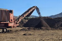
The Earth Rover program, a non-profit initiative co-founded by soil ecologist Simon Jeffery and writer George Monbiot, adapts seismology tools normally used for studying the Earth’s crust or locating hydrocarbons. By placing a metal plate on the ground and striking it with a hammer, researchers can measure how waves pass through and reflect off different layers. Variations in the signal can indicate compacted subsoil, dryness, and the presence of biological activity.
Jeffery said the approach offers a level of detail unavailable from existing mapping systems. Even the UK’s national soil map, considered the most advanced globally, is based on a grid too coarse to capture field-level differences. At Harper Adams University in Shropshire, he said, broad soil categories have proved inaccurate when checked with the seismic method, which identified many more soil types and pockets of peat than previously recorded.
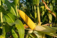
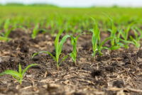
Researchers argue that such information could help farmers tailor interventions more effectively. Crop performance can vary sharply across small distances due to invisible soil differences, leading to blanket tillage and fertiliser use that raise costs and environmental impacts. More refined mapping, they say, would allow targeted management to improve productivity and cut soil degradation.
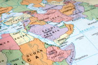
In Kenya, where many farmers lack access to soil laboratories, the technology could help identify subsoil compaction that contributes to runoff, flooding and poor root development, according to soil scientist Peter Mosongo. He said the system’s portability and limited disturbance make it suitable for smallholders who have never carried out formal testing.
The developers plan to release a free app to guide farmers through soil assessments and provide recommendations on improving organic matter, managing water needs and addressing compaction. They also aim to refine the method to estimate soil carbon stocks, an area where current calculations rely heavily on assumptions.
Independent experts say the technique shows promise but requires further validation. Aidan Keith, a soil ecologist at the UK Centre for Ecology and Hydrology, said seismic-wave analysis could become a valuable tool if sensor technologies and data-interpretation methods continue to advance, adding that interdisciplinary work will be essential to establish accuracy limits.
Researchers involved in the project argue that more precise soil data is becoming increasingly important as climate-related pressures and long-term degradation threaten agricultural productivity. They warn that without improved management tools, rising populations could outpace gains in yields in many regions.
Enjoyed this story?
Every Monday, our subscribers get their hands on a digest of the most trending agriculture news. You can join them too!


Discussion0 comments