

Gulf of Mexico dead zone shrinks to 1,332 square miles in 2026



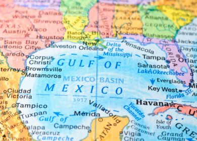
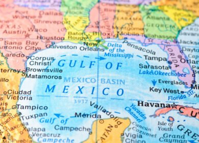
The annual low-oxygen “dead zone” in the northern Gulf of Mexico was dramatically smaller in 2026, falling to approximately 1,332 square miles — the second smallest area recorded during 40 years of annual measurements.
The result represents a sharp reversal from 2024, when the hypoxic zone covered about 6,705 square miles. However, scientists caution that the unusually small 2026 measurement does not mean nutrient pollution from the Mississippi-Atchafalaya River Basin has been solved.
According to NOAA, Tropical Storm Bertha passed through the northern Gulf shortly before the annual monitoring cruise, mixing oxygen-rich surface water into deeper layers and temporarily reducing the extent of hypoxia.
NOAA currently refers to the area as the Gulf of America, formerly the Gulf of Mexico. This article uses Gulf of Mexico where appropriate for continuity with previous Fertilizer Daily coverage and established scientific terminology.
Gulf dead zone fell sharply in 2026
Scientists from Louisiana State University and the Louisiana Universities Marine Consortium conducted the annual survey aboard the research vessel Pelican from July 24 to July 30, 2026.
The measured hypoxic zone covered 1,332 square miles, far below both the previous year’s result and NOAA’s pre-season forecast.
| Year / measurement | Dead zone size | Context |
|---|---|---|
| 2024 measured | 6,705 sq mi | Above-average hypoxic zone |
| 2025 measured | 4,402 sq mi | Below long-term average |
| 2026 NOAA forecast | 7,027 sq mi | Above-average zone expected |
| 2026 measured | 1,332 sq mi | Second smallest in the 40-year record |
The 2026 zone was therefore roughly one-fifth the size measured in 2024 and substantially smaller than NOAA expected before the summer survey.
For comparison, the largest recorded Gulf dead zone covered 8,776 square miles in 2017. The long-term policy goal is to reduce the five-year average to less than 1,900 square miles by 2035.
Why NOAA expected a much larger dead zone
In June 2026, NOAA forecast that the summer hypoxic zone would cover approximately 7,027 square miles, which would have been larger than the long-term average.
The forecast was based primarily on Mississippi and Atchafalaya river flow and nutrient-loading data collected by the U.S. Geological Survey.
| May 2026 indicator | Compared with long-term average |
|---|---|
| Mississippi-Atchafalaya river discharge | 36% below average |
| Nitrate load | 4% above average |
| Phosphorus load | 6% below average |
Nitrogen and phosphorus entering the Gulf are important because they stimulate algae growth. When algae eventually die and decompose, microorganisms consume dissolved oxygen in deeper water, creating hypoxic conditions where many marine organisms cannot survive.
The forecast models assumed more typical summer weather conditions. What happened immediately before the monitoring cruise was very different.
Tropical Storm Bertha disrupted the 2026 dead zone
The main reason the measured zone was so much smaller than forecast was the passage of Tropical Storm Bertha through the northern Gulf shortly before scientists began their survey.
NOAA scientists reported that storm-force winds and waves mixed the water column, moving oxygen-rich surface water toward the seafloor.
This process can temporarily break down the stratification that allows hypoxia to develop.
Normally, freshwater from the Mississippi River sits above denser saltwater. The separation between these layers limits vertical mixing and makes it difficult for oxygen at the surface to reach deeper water.
A strong storm can disrupt those layers and temporarily reoxygenate bottom waters.
This means the 2026 measurement should not be interpreted as evidence that nitrogen and phosphorus inputs suddenly fell enough to eliminate the underlying hypoxia problem.
How fertilizer nutrients contribute to Gulf hypoxia
The Gulf dead zone is linked to nutrient pollution across the enormous Mississippi-Atchafalaya River Basin, which drains agricultural, urban and industrial areas across much of the central United States.
The U.S. Environmental Protection Agency identifies excessive nitrogen and phosphorus as key drivers of Gulf hypoxia.
Major nutrient sources include:
- agricultural fertilizer runoff;
- manure and livestock operations;
- soil erosion;
- municipal wastewater;
- industrial discharges;
- urban runoff;
- atmospheric nitrogen deposition.
Agriculture is particularly important because the Mississippi River Basin contains some of the most productive corn, soybean and other crop-growing regions in the United States.
Nitrogen and phosphorus fertilizers are essential to crop production, but nutrients that are not absorbed by crops can move through drainage systems, groundwater and surface runoff into streams and rivers.
Those nutrients eventually reach the Mississippi and Atchafalaya rivers and can be transported into the Gulf.
Nitrogen pollution has fallen, but phosphorus remains a problem
The unusually small 2026 dead zone occurred at the same time that federal and state agencies reported mixed progress in reducing nutrient loads across the Mississippi River Basin.
In June 2026, the EPA’s Hypoxia Task Force reported that total nitrogen loads had declined by 28% compared with the program’s baseline period.
This surpassed the interim target of reducing nitrogen loads by 20%.
Phosphorus moved in the opposite direction. The same assessment found that total phosphorus loads were approximately 13% higher than the baseline.
| Nutrient | 2025 interim target | Reported progress |
|---|---|---|
| Total nitrogen | 20% reduction | 28% reduction |
| Total phosphorus | 20% reduction | 13% increase |
The difference illustrates why nutrient management cannot focus on nitrogen alone.
Phosphorus can remain stored in soils, sediments and watersheds for long periods, meaning improvements in fertilizer management may take years before they are fully reflected in downstream water quality.
The 2024 and 2026 measurements tell very different stories
When Fertilizer Daily previously covered the Gulf dead zone in 2024, scientists measured an area of approximately 6,705 square miles.
At the time, the zone was the 12th largest measured during the monitoring record and substantially exceeded the Hypoxia Task Force’s long-term goal.
The change between 2024 and 2026 is striking:
| Indicator | 2024 | 2026 |
|---|---|---|
| Measured dead zone | 6,705 sq mi | 1,332 sq mi |
| Relative status | Above average | Second smallest on record |
| Main immediate weather influence | No comparable pre-survey storm mixing event | Tropical Storm Bertha mixed the water column |
However, annual measurements can vary significantly because weather, storms, river flow, temperature and ocean circulation all affect the size of the hypoxic zone.
For that reason, scientists and regulators place greater emphasis on multi-year averages and long-term nutrient-loading trends than on a single annual result.
The U.S. target remains 1,900 square miles
The federal-state Mississippi River/Gulf Hypoxia Task Force has set a goal of reducing the five-year running average of the hypoxic zone to less than 5,000 square kilometers, or approximately 1,900 square miles, by 2035.
The strategy depends primarily on reducing nitrogen and phosphorus entering the Mississippi-Atchafalaya River Basin.
State nutrient-reduction programs include measures such as:
- more precise fertilizer application;
- cover crops;
- buffer strips;
- wetland restoration;
- improved drainage management;
- manure nutrient management;
- wastewater treatment upgrades;
- water-quality monitoring.
The EPA notes that individual states within the Mississippi-Atchafalaya Basin maintain their own nutrient-reduction strategies because agricultural conditions, crops, soils and nutrient sources differ substantially across the watershed.
Why fertilizer management remains central to the issue
The 2026 result demonstrates the difficulty of judging fertilizer and nutrient-management policy from the size of a single year’s dead zone.
Agricultural nutrient losses can be reduced through improved fertilizer efficiency, but the relationship between fertilizer application and Gulf hypoxia is affected by several factors:
- Weather. Heavy rainfall can increase nutrient runoff from farmland.
- River discharge. Higher river flow can transport more nutrients toward the Gulf.
- Timing of fertilizer applications. Nutrients applied shortly before major rainfall events face a greater risk of being lost.
- Soil nutrient reserves. Previously accumulated phosphorus can continue entering waterways for years.
- Crop uptake. Better nutrient-use efficiency can reduce the amount of nitrogen and phosphorus remaining in the soil.
- Ocean conditions. Winds, storms and water-column mixing can substantially alter the measured dead zone even when nutrient loads remain elevated.
For fertilizer producers and agricultural advisers, the policy trend increasingly favors technologies and practices that improve nutrient-use efficiency while maintaining crop yields.
These include enhanced-efficiency fertilizers, controlled-release products, nitrification inhibitors, precision application systems and improved nutrient-management planning.
Why the small 2026 dead zone should be interpreted cautiously
The 1,332-square-mile measurement is clearly positive for marine habitat during the survey period, but scientists have emphasized the role of Tropical Storm Bertha in producing the unusually low result.
The annual survey is essentially a snapshot of conditions during a specific period. A storm arriving shortly before scientists collect measurements can significantly change oxygen conditions without permanently altering nutrient inputs.
Several indicators therefore remain important:
- long-term nitrogen loading;
- phosphorus loading;
- the five-year average size of the hypoxic zone;
- fertilizer-use efficiency in major agricultural states;
- adoption of nutrient-reduction practices;
- future annual NOAA surveys.
The substantial reduction in nitrogen loads reported by the Hypoxia Task Force suggests progress in one major area, while continued high phosphorus loading shows that significant challenges remain.
What happens next
NOAA, EPA, USGS, universities and state agencies will continue monitoring nutrient movement through the Mississippi River Basin and the annual development of the Gulf hypoxic zone.
The next several years will be particularly important because the Hypoxia Task Force is working toward its 2035 target.
For the fertilizer industry, the issue is increasingly connected to a broader shift toward producing more food with fewer nutrient losses.
The 2026 dead zone may have been the second smallest ever recorded, but the difference between NOAA’s 7,027-square-mile forecast and the eventual 1,332-square-mile measurement also demonstrates how strongly short-term weather can influence annual results.
Long-term reductions in nitrogen and phosphorus entering the Gulf — rather than a single unusually small annual measurement — will remain the key indicator of whether agricultural and environmental nutrient-management policies are working.
Sources: NOAA, EPA, NOAA Ocean Service

Enjoyed this story?
Every Monday, our subscribers get their hands on a digest of the most trending agriculture news. You can join them too!





Discussion0 comments