GeoPard Agriculture unveils new precision agriculture features


GeoPard Agriculture has announced a series of updates aimed at enhancing the functionality and user experience of its precision agriculture software. The updates, which were rolled out over the recent holiday period, include a new pricing model, advanced data management protocols, and additional support for Spanish-speaking users.
Among the key features introduced is a new, more transparent pricing model designed to accommodate a variety of user needs, from individual farmers to large enterprises. This model includes a free 30-day trial with no credit card required, a pay-as-you-go option, and annual subscription plans. This change aims to make precision agriculture more accessible by allowing users to select the plan that best fits their budget and usage requirements.
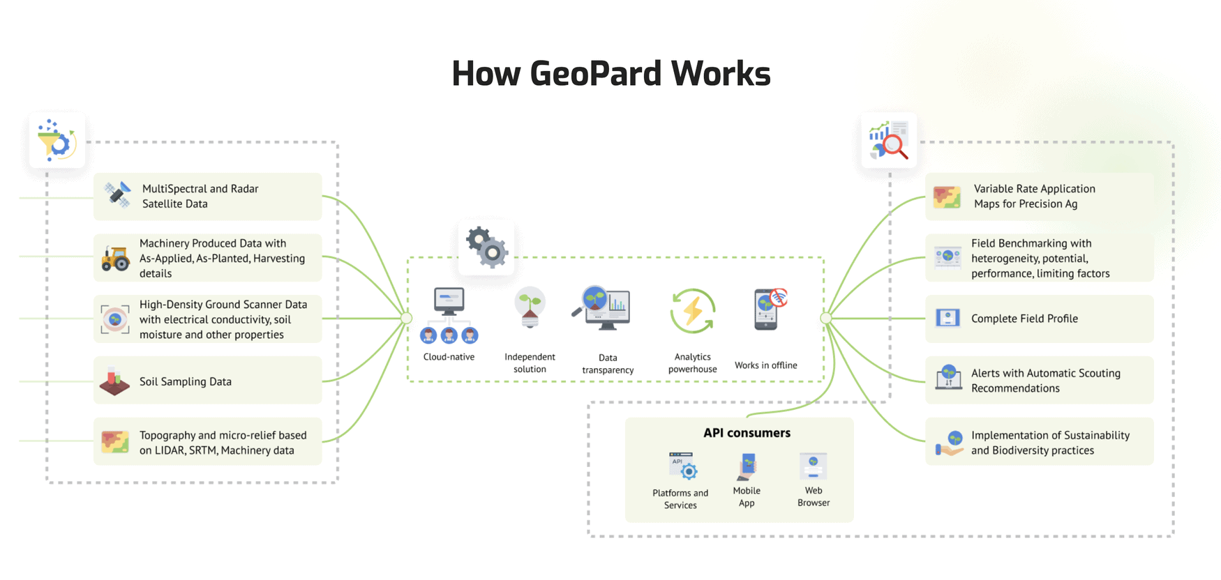
GeoPard has also enhanced its data management capabilities. The software now supports the USDA Yield Cleaning protocol, which automatically links and adjusts crucial data fields such as Yield, Delay, Velocity, and Swath Width, eliminating the need for manual data cleaning. Additionally, GeoPard has simplified the process of exporting cleaned and calibrated yield data to the John Deere Ops Center, which now seamlessly integrates this data as a Harvesting file.
Another significant update is the introduction of the Spatially Localized Classification for soil sampling. This feature allows users to generate zone maps that consider both geographic proximity and data values, offering three modes of classification: focusing on data values, geographic proximity, or a balanced approach.
The software’s new functionalities also extend to agronomic calculations. GeoPard has launched a set of agronomic functions that simplify complex calculations, such as nitrogen uptake and the cost of agricultural inputs, into single-line equations. These enhancements are designed to facilitate more accurate and efficient decision-making on fertilizer and seeding applications.
Additionally, the update includes support for multi-zone application maps, import of KML and KMZ field boundaries, expanded activity logs, and a new Spanish localization option to cater to its growing user base in Spanish-speaking regions.
GeoPard Agriculture is hosting a free webinar on January 27th to provide further insights into these new features and discuss upcoming developments in precision agriculture. Interested participants can register online to learn more about leveraging GeoPard’s capabilities for optimized farm management and increased productivity.
Enjoyed this story?
Every Monday, our subscribers get their hands on a digest of the most trending agriculture news. You can join them too!


Discussion0 comments