University of Florida scientists to build AI tool for crop damage assessment after hurricanes


University of Florida (UF) researchers are developing a generative AI tool to help farmers assess hurricane-related crop damage using satellite imagery. The project, led by Nikolaos Tziolas of the UF Institute of Food and Agricultural Sciences (UF/IFAS), has received a $297,000 grant from the USDA National Institute of Food and Agriculture.
Tziolas, an assistant professor at the UF/IFAS Southwest Florida Research and Education Center, is designing a chat-based platform that will allow farmers and Extension agents to access and interpret satellite data through a simple web interface. Accessible via smartphones or computers, the system will enable users to ask field-specific questions such as “How much of my farm is flooded?” or “How did my crops do, compared to last year?” and receive tailored responses supported by maps and historical comparisons.
“Traditional methods for assessing such damage are often slow, complex and expensive, limiting their effectiveness in time-sensitive disaster response efforts,” said Tziolas. “This project aims to address these challenges by developing an AI conversational platform that enables farmers, policymakers and other non-experts to assess crop damage and monitor recovery, using satellite data and artificial intelligence.”
The platform will also enhance existing satellite data to deliver more detailed insights for growers, potentially supporting integration with crop insurance assessments and precision agriculture platforms. This could allow insurers and ag-tech providers to evaluate damage more efficiently, reducing time to claims resolution and helping refine planting or recovery strategies.
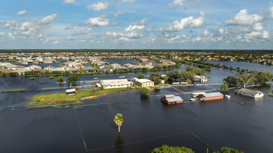
While the initial focus is on Florida—a state that suffered agricultural losses between $190.4 million and $642.7 million during last year’s Hurricane Milton—the technology is designed for broader application. Regions across the Gulf Coast, the Southeastern US, and the Caribbean, all prone to tropical storms and hurricanes, could also benefit from the platform.
Current damage assessment practices often require time-consuming on-site inspections or expensive drone operations. Tziolas noted that such methods provide only a snapshot of conditions and lack scalability. In contrast, the AI tool will offer a broader, time-sensitive view of crop health and flooding across entire farms.
“By making advanced technology accessible and actionable, this platform will help users reduce costs and improve resilience to extreme weather events in the future—by knowing where to plant,” he said.
The project reflects a growing push to apply AI and remote sensing to agricultural disaster response and climate resilience efforts.
Enjoyed this story?
Every Monday, our subscribers get their hands on a digest of the most trending agriculture news. You can join them too!


Discussion0 comments